Learn about Nanki-Kumano Geopark
Culture and History
Cultural and Natural Richness of Nanki-Kumano
Nanki-Kumano’s rugged mountain passes, river paths winding through valleys, and maritime routes connecting to various Japanese ports have long facilitated the movement of people and goods, enriching the region’s culture over time.
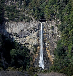
The mountainous terrain of the Nanki-Kumano region fostered a deep reverence for nature. Deep forests, cascading waterfalls, and giant stones were seen as imbued with spiritual power or deities. A prime example is the awe-inspiring Nachi Grand Waterfall, a national historic site and a sacred element of Kumano Nachi Taisha Grand Shrine. This profound respect for the natural world laid the foundation for Shinto, Japan’s unique indigenous religion.
The arrival of Buddhism from abroad further enriched the region’s spirituality. This led to a unique blend of Shinto and Buddhist beliefs, known as Shinto-Buddhist syncretism. Under Buddhist influence, Kumano gained prominence as a center for mountain asceticism, strengthening the existing worship practices.
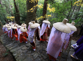
By the Heian era (794-1185), pilgrimages to Kumano seeking worldly benefits surged in popularity. Inclusive and open to all, regardless of social status or gender, these pilgrimages attracted a vast array of people, from emperors to commoners and even the physically challenged. The sight of countless pilgrims following narrow mountain paths came to be known as “ants’ Kumano Pilgrimage.” In recognition of its cultural significance, the pilgrimage route, Kumano Kodo, was regsitered as a UNESCO World Heritage site in 2004 under the title “Sacred Sites and Pilgrimage Routes in the Kii Mountain Range.”
Nestled amidst towering mountains, the Kitayama River basin has utilized the region’s rich forests and waterways for centuries. Timber harvested from the mountains was transported down to the river using sleds or specially constructed chutes. Once at the riverbank, the logs were assembled into rafts and navigated downstream to Shingu City. Over time, this interaction fostered strong cultural and social bonds between the upstream villages and downstream communities.
An interesting anomaly emerged in 1871 during a nationwide administrative reshuffle. Though newly designated within the area of Mie Prefecture, the residents of Kitayama Village, feeling strong connections to downstream Wakayama Prefecture, opted to remain under Wakayama’s administration. This unique choice resulted in Kitayama Village becoming the sole prefectural ‘island’ within another prefecture in Japan.
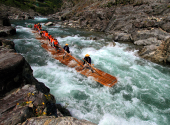
Historic Navigation of the Kumano River Basin
The Kumano River basin boasts a rich history of river navigation that has played a crucial role in the transportation of goods and people since ancient times. During the Heian era (794-1185), the region was known as a “river pilgrimage route” due to the frequent visits by royalty and nobles for the Kumano pilgrimage. In the Edo era (1603-1867), larger flat-bottomed riverboats were introduced, and in modern times, propeller and jet boats have significantly enhanced transport capabilities.
The Kumano River, together with its tributary the Kitayama River, served as vital conduits linking the mountainous interiors to the coastal areas. Similarly, towns prospered at the mouths of the Hiki, Kozagawa, and Ota Rivers, serving as hubs for the distribution of goods and as intermediaries between the mountains and the sea.
During the Edo era (1603-1867), the Shirahama-Shingu area thrived as a center of maritime trade. Ships transported a diverse array of goods, including rice, sake, soy sauce, charcoal, lumber, medicine, kerosene, kimono, and even weapons, between Shirahama-Shingu, Edo, and Osaka. Additionally, small vessels known as “Isaba-sen” enhanced regional transport, making the coastline an essential artery for both long-distance and local trade.
The east coast of Cape Shionomisaki was particularly challenging for mariners, especially when sailing westward against the Kuroshio Current. The strong currents and waves posed significant dangers, requiring sailors to rely on visible coastal landmarks for navigation. These included Mt. Kasaneyama in Kushimoto Town, Tomyozaki and Kandorizaki in Taiji Town, Nachi Falls in Nachi-katsuura Town, and Mt. Kamikura in Shingu City.
The treacherous waters around Cape Shionomisaki continued to challenge navigation into the Meiji era (1868-1912), leading to notable historical incidents like the British Normanton shipwreck (1886) and the Turkish Ertugrul shipwreck (1890). In response, Japan erected its first Western-style stone lighthouse at Cape Kashinozaki and its first wooden lighthouse at Cape Shionomisaki to improve safety measures. From the Meiji era to the present, the Kii Peninsula has remained a crucial route for domestic and international vessels, with Cape Shionomisaki offering views of ships traversing these historic waters.
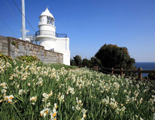
The Enchanting Natural Beauty of the Kii Peninsula
The Kii Peninsula’s landscapes, characterized by grand mountains, lush fields, and untouched beaches, have attracted notable figures, including politicians and geologists. Recognizing the natural beauty, Yoshino-Kumano National Park was established in 1936 as a national recreation area, continuing to nurture a culture that values and utilizes the region’s natural assets.
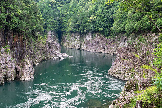
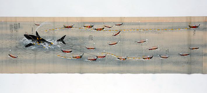
Traditional whaling activities were prevalent along the coast from Koza in Kushimoto Town to Shingu City. Taiji Town, in particular, has a longstanding history as a center for whaling, preserving Japanese whaling culture through generations.
