Learn about Nanki-Kumano Geopark
Disaster prevention
The Nanki-Kumano Region’s History with Tsunami Disasters
The Nanki-Kumano region has a historical vulnerability to tsunamis caused by powerful earthquakes along the oceanic trench. In 1944, the Showa Tonankai Earthquake triggered a catastrophic tsunami that hit Nachi Bay in Nachi-Katsuura Town, sweeping away the JR Kisei Line tracks and demolishing Kii-Katsuura Station. Two years later, in 1946, the Showa Nankai Earthquake unleashed another tsunami that affected the coastline from Shirahama Town to Kushimoto Town, with waves exceeding six meters in areas like Fukuro in Kushimoto Town.
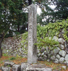
Over 30 tsunami warning signs and monuments are erected along the coast between Shirahama and Kushimoto towns, serving as reminders of preparedness and preserving the wisdom of those who faced these destructive waves.
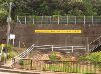
One prominent monument stand out in Kushimoto Town, carved directly into a mountainside. It marks the high-water line of a past tsunami, nearly 8 meters high, clearly visible from the national road. In Nachi-katsuura Town, the Tenma district honors the memory of the tsunami with a commemorative monument.
Another story from the town’s Ichino district speaks of the tsunami’s power. Here, the receding wave left fish snagged high in the branches of trees, a location now known as “Fish’s Neck,” a permanent reminder of the tsunami’s wrath.
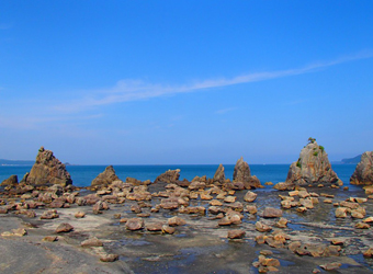
Beyond preserving memories of the past, Nanki-Kumano is actively involved in research to predict future earthquakes, such as studying the massive debris near Hashigui-iwa Rocks in Kushimoto Town, thought to have been displaced by a historic tsunami. Analyzing these rock movements and ages offers critical insights into past seismic activities, with ongoing studies aimed at understanding the recurrence patterns of massive tsunamis and enhancing regional disaster preparedness.
The region, known for its heavy rainfall, has endured repeated landslides and flooding. Notable events like the Totsukawa Flood in 1888 and the Kii Peninsula Flood in 2011 highlight its susceptibility to extreme weather.
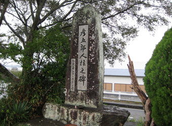
Kamitonda’s legend of Hikogoro, who sacrificed himself to construct a levee to protect his village from the frequent flooding of the Tonda River, reflects the historical fear and respect for nature’s power. This tale emphasizes the community’s desire for safety from floods.
Living next to robust rivers has fostered ingenuity in dealing with environmental challenges, such as “river switching” techniques used to divert water flows to protect nearby communities and farmlands. This practical ingenuity is also evident in submersible bridges over the Tonda and Kozagawa Rivers, designed to withstand floods by submerging during high water without damage, enabling continued use after waters recede.
